Geolocate

Chinchaycocha topographic map

Click on the map to display elevation.

About this map

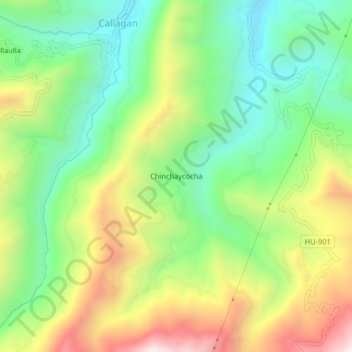
Name: Chinchaycocha topographic map, elevation, terrain.

Location: Chinchaycocha, Molino, Provincia de Pachitea, Huánuco, Perú (-10.00118 -76.06254 -9.96118 -76.02254)

Average elevation: 9,360 ft

Minimum elevation: 8,189 ft

Maximum elevation: 11,155 ft

Gear up for your next adventure:

🎒Gear Packing Cubes - Organize your backpack efficiently
📱Solar Portable Charger - Solar power bank for charging devices off‑grid
❄️Traction Cleats - Prevent slips on icy trails during winter hikes
🥇GPS Hiking Watch - Multi‑sport GPS watch with navigation and trail tracking
👖Convertible Hiking Pants - Versatile zip-off pants for changing altitudes and temperatures

As an Amazon Associate, this site earns from qualifying purchases at no extra cost to you.