Geolocate

Orogolday topographic map

Click on the map to display elevation.

About this map

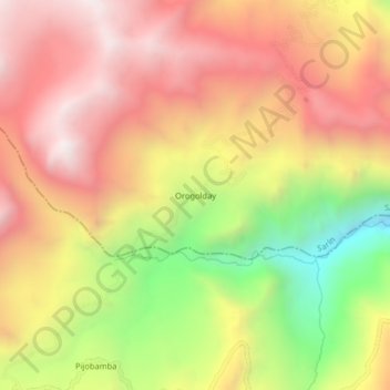
Name: Orogolday topographic map, elevation, terrain.

Location: Orogolday, Sarín, Sánchez Carrión, La Libertad, Perú (-8.02136 -77.81495 -7.98136 -77.77495)

Average elevation: 12,110 ft

Minimum elevation: 9,688 ft

Maximum elevation: 13,875 ft

Gear up for your next adventure:

🛠️Backpacking Tool Kit - Essential toolkit for outdoor repairs
📷Action Cameras - Rugged cameras to document your journeys across rugged terrain
🪶Trail Camera - Capture wildlife on your hikes
🚗GPS Dash Cams - Record your scenic drives through mountain passes and canyons
🧤Tactile Hiking Gloves - Keep hands warm while operating GPS and smartphone screens

As an Amazon Associate, this site earns from qualifying purchases at no extra cost to you.