
Thank you for supporting this site ❤️
Make a donation
Make a donation
Gear up for your next adventure:
As an Amazon Associate, this site earns from qualifying purchases at no extra cost to you.
Hasenacker topographic map
Click on the map to display elevation.
Thank you for supporting this site ❤️
Make a donation
Make a donation
Gear up for your next adventure:
As an Amazon Associate, this site earns from qualifying purchases at no extra cost to you.
About this map
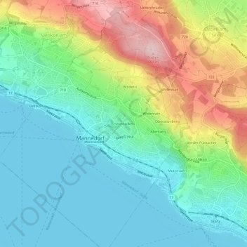
Name: Hasenacker topographic map, elevation, terrain.
Location: Hasenacker, Männedorf, Bezirk Meilen, Zurich, 8708, Switzerland (47.23547 8.67978 47.27547 8.71978)
Average elevation: 1,588 ft
Minimum elevation: 1,319 ft
Maximum elevation: 2,169 ft
Thank you for supporting this site ❤️
Make a donation
Make a donation
Gear up for your next adventure:
As an Amazon Associate, this site earns from qualifying purchases at no extra cost to you.