
Thank you for supporting this site ❤️
Make a donation
Make a donation
Gear up for your next adventure:
As an Amazon Associate, this site earns from qualifying purchases at no extra cost to you.
l'Esquirol topographic map
Click on the map to display elevation.
Thank you for supporting this site ❤️
Make a donation
Make a donation
Gear up for your next adventure:
As an Amazon Associate, this site earns from qualifying purchases at no extra cost to you.
About this map
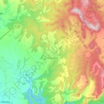
Name: l'Esquirol topographic map, elevation, terrain.
Location: l'Esquirol, Osona, Barcelone, Catalogne, 08511, Espagne (41.99250 2.29421 42.08678 2.42934)
Average elevation: 2,507 ft
Minimum elevation: 1,332 ft
Maximum elevation: 4,272 ft
Thank you for supporting this site ❤️
Make a donation
Make a donation
Gear up for your next adventure:
As an Amazon Associate, this site earns from qualifying purchases at no extra cost to you.
Other topographic maps
Click on a map to view its topography, its elevation and its terrain.