
Make a donation
Gear up for your next adventure:
As an Amazon Associate, this site earns from qualifying purchases at no extra cost to you.
Walkersbrunn topographic map
Click on the map to display elevation.
Make a donation
Gear up for your next adventure:
As an Amazon Associate, this site earns from qualifying purchases at no extra cost to you.
Walkersbrunn
Das Kirchdorf liegt in der naturräumlichen Landschaftseinheit Erlanger Albvorland etwa drei Kilometer westnordwestlich von Gräfenberg und liegt auf einer Höhe von 437 m ü. NHN. Das Dorf liegt im oberen Tal der Schwabach, am südlichen Fuß des Albtraufes der Nördlichen Frankenalb.
Make a donation
Gear up for your next adventure:
As an Amazon Associate, this site earns from qualifying purchases at no extra cost to you.
About this map
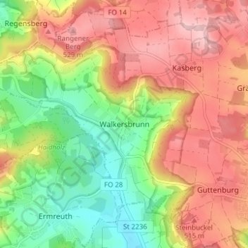
Name: Walkersbrunn topographic map, elevation, terrain.
Average elevation: 1,467 ft
Minimum elevation: 1,122 ft
Maximum elevation: 1,795 ft
Make a donation
Gear up for your next adventure:
As an Amazon Associate, this site earns from qualifying purchases at no extra cost to you.