Geolocate

Canchacucho topographic map

Click on the map to display elevation.

About this map

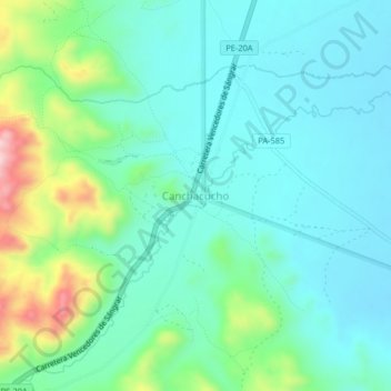
Name: Canchacucho topographic map, elevation, terrain.

Location: Canchacucho, Huayllay, Provincia de Pasco, Pasco, Perú (-10.97783 -76.33538 -10.93783 -76.29538)

Average elevation: 13,612 ft

Minimum elevation: 13,392 ft

Maximum elevation: 14,324 ft

Gear up for your next adventure:

📚USA Hiking Guide Books - Top trail guides and map books
🪑Portable Camp Table - Compact table for campsite meals
🧤Tactile Hiking Gloves - Keep hands warm while operating GPS and smartphone screens
🎁Geography Themed Gifts - Unique gift ideas for map lovers and geography enthusiasts
🌐World Map Poster - Decorative world maps with topographic info

As an Amazon Associate, this site earns from qualifying purchases at no extra cost to you.