
Thank you for supporting this site ❤️
Make a donation
Make a donation
Gear up for your next adventure:
As an Amazon Associate, this site earns from qualifying purchases at no extra cost to you.
Chao Phraya Surasak topographic map
Click on the map to display elevation.
Thank you for supporting this site ❤️
Make a donation
Make a donation
Gear up for your next adventure:
As an Amazon Associate, this site earns from qualifying purchases at no extra cost to you.
About this map
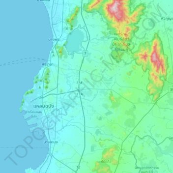
Name: Chao Phraya Surasak topographic map, elevation, terrain.
Location: Chao Phraya Surasak, Si Racha, Chon Buri Province, Thailand (12.96419 100.83970 13.28419 101.15970)
Average elevation: 256 ft
Minimum elevation: 0 ft
Maximum elevation: 2,559 ft
Thank you for supporting this site ❤️
Make a donation
Make a donation
Gear up for your next adventure:
As an Amazon Associate, this site earns from qualifying purchases at no extra cost to you.