
Grove City topographic map
Click on the map to display elevation.
About this map
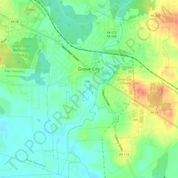
Name: Grove City topographic map, elevation, terrain.
Location: Grove City, Mercer County, Pennsylvania, United States (41.13572 -80.11591 41.17231 -80.06645)
Average elevation: 1,266 ft
Minimum elevation: 1,201 ft
Maximum elevation: 1,371 ft
Mercer County trails, hiking, mountain biking, running and outdoor activities
Other topographic maps
Click on a map to view its topography, its elevation and its terrain.
Little Shenango Dam
United States > Pennsylvania > Mercer County > Perry Township
Average elevation: 1,227 ft
Millburn
United States > Pennsylvania > Mercer County > Springfield Township
Average elevation: 1,168 ft
Millburn
United States > Pennsylvania > Mercer County > Springfield Township
Average elevation: 1,168 ft
Schollard
United States > Pennsylvania > Mercer County > Springfield Township > Leesburg
Average elevation: 1,243 ft