
Gelderse Poort topographic map
Interactive map
Click on the map to display elevation.
About this map
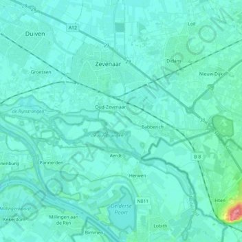
Name: Gelderse Poort topographic map, elevation, terrain.
Location: Gelderse Poort, Aerdt, Zevenaar, Gelderland, Nederland (51.85902 5.93817 51.95979 6.11796)
Average elevation: 43 ft
Minimum elevation: 16 ft
Maximum elevation: 266 ft
Other topographic maps
Click on a map to view its topography, its elevation and its terrain.
Aerdt
Nederland > Gelderland > Aerdt
Aerdt, Gelderland, Nederland, 6913, Nederland
Average elevation: 39 ft