
Aerdt topographic map
Interactive map
Click on the map to display elevation.
About this map
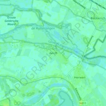
Name: Aerdt topographic map, elevation, terrain.
Location: Aerdt, Gelderland, Nederland, 6913, Nederland (51.87376 6.06450 51.91376 6.10450)
Average elevation: 39 ft
Minimum elevation: 26 ft
Maximum elevation: 62 ft
Other topographic maps
Click on a map to view its topography, its elevation and its terrain.
Gelderse Poort
Nederland > Gelderland > Aerdt
Gelderse Poort, Aerdt, Zevenaar, Gelderland, Nederland
Average elevation: 43 ft