
Thank you for supporting this site ❤️
Make a donation
Make a donation
Gear up for your next adventure:
As an Amazon Associate, this site earns from qualifying purchases at no extra cost to you.
Relvas topographic map
Click on the map to display elevation.
Thank you for supporting this site ❤️
Make a donation
Make a donation
Gear up for your next adventure:
As an Amazon Associate, this site earns from qualifying purchases at no extra cost to you.
About this map
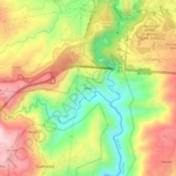
Name: Relvas topographic map, elevation, terrain.
Location: Relvas, Parada de Cunhos, Vila Real, 5000-103, Portugal (41.25374 -7.77854 41.29374 -7.73854)
Average elevation: 1,322 ft
Minimum elevation: 545 ft
Maximum elevation: 2,090 ft
Thank you for supporting this site ❤️
Make a donation
Make a donation
Gear up for your next adventure:
As an Amazon Associate, this site earns from qualifying purchases at no extra cost to you.