
Thank you for supporting this site ❤️
Make a donation
Make a donation
Gear up for your next adventure:
As an Amazon Associate, this site earns from qualifying purchases at no extra cost to you.
Glashütte topographic map
Click on the map to display elevation.
Thank you for supporting this site ❤️
Make a donation
Make a donation
Gear up for your next adventure:
As an Amazon Associate, this site earns from qualifying purchases at no extra cost to you.
About this map
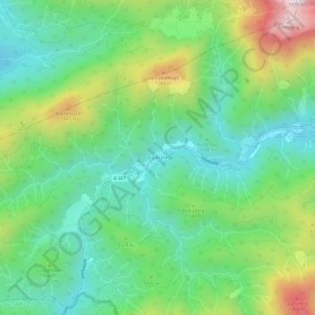
Name: Glashütte topographic map, elevation, terrain.
Location: Glashütte, Kreuth, Landkreis Miesbach, Bayern, Deutschland (47.59179 11.63014 47.63179 11.67014)
Average elevation: 3,543 ft
Minimum elevation: 2,769 ft
Maximum elevation: 5,194 ft
Thank you for supporting this site ❤️
Make a donation
Make a donation
Gear up for your next adventure:
As an Amazon Associate, this site earns from qualifying purchases at no extra cost to you.