Geolocate

Buk-gu topographic map

Click on the map to display elevation.

About this map

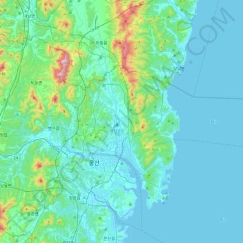
Name: Buk-gu topographic map, elevation, terrain.

Location: Buk-gu, Ulsan, South Korea (35.51647 129.28979 35.67929 129.72062)

Average elevation: 312 ft

Minimum elevation: -3 ft

Maximum elevation: 2,477 ft

Gear up for your next adventure:

📚USA Hiking Guide Books - Top trail guides and map books
🗻Climbing Gear Basics - Essential gear for beginner climbers
🧥Men's Rain Shells - Premium waterproof and breathable jackets for mountain weather
📦Gear Storage Bags - Organize and protect outdoor equipment
🗺️Topographic Maps - Detailed topo maps for hiking, exploring and outdoor navigation

As an Amazon Associate, this site earns from qualifying purchases at no extra cost to you.