Geolocate

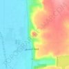
Jamala topographic map

Click on the map to display elevation.

About this map

Name: Jamala topographic map, elevation, terrain.

Location: Jamala, As-Salamiye Subdistrict, As-Salamiye District, Hama Governorate, Syria (34.94752 36.92056 34.98752 36.96056)

Average elevation: 1,539 ft

Minimum elevation: 1,319 ft

Maximum elevation: 1,621 ft

Other topographic maps

Click on a map to view its topography, its elevation and its terrain.

Orontes River

Syria > Hama Governorate > Qarqur

Average elevation: 574 ft

Hama

Syria > Hama Governorate

Average elevation: 1,020 ft

Hama

Syria > Hama Governorate

Average elevation: 1,020 ft

Hama

Syria > Hama Governorate

Average elevation: 1,020 ft

Qalaat al-Madiq

Syria > Hama Governorate

Average elevation: 705 ft

Hama

Syria > Hama Governorate

Average elevation: 1,020 ft

Qalaat al-Madiq

Syria > Hama Governorate

Average elevation: 705 ft

Hama

Syria > Hama Governorate

Average elevation: 1,020 ft

Gear up for your next adventure:

📡GPS Antenna Upgrade - Enhance GPS reception in remote terrain
🛡️Bear Spray Outdoor - Protection in bear country hikes
🪄Magnetic Compass - Accurate compass for navigation
🛠️Outdoor Gear Repair Kit - Essential tools to fix gear on the trail
🛰️Handheld GPS Units - Professional satellite navigators for precise backcountry mapping

As an Amazon Associate, this site earns from qualifying purchases at no extra cost to you.