Geolocate

Roth topographic map

Click on the map to display elevation.

Roth

Im Geographischen statistisch-topographischen Lexikon von Franken (1801) wird der Ort folgendermaßen beschrieben.

Wikipedia (CC-BY-SA 3.0)

About this map

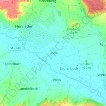
Name: Roth topographic map, elevation, terrain.

Location: Roth, Herrieden, Landkreis Ansbach, Bayern, 91567, Deutschland (49.20590 10.49463 49.24590 10.53463)

Average elevation: 1,414 ft

Minimum elevation: 1,365 ft

Maximum elevation: 1,594 ft

Gear up for your next adventure:

🩳Quick‑Dry Hiking Shorts - Comfortable and quick‑dry shorts for summer hiking
🦶Hiking Gaiters - Keep debris and water out of your boots
📡Handheld GPS Device - Reliable handheld GPS for outdoor navigation
🏫Relief Map Kits - Hands-on tools for teaching landforms and elevation
🔭Telescopic Hiking Pole - Adjustable pole for hiking stability

As an Amazon Associate, this site earns from qualifying purchases at no extra cost to you.