
Make a donation
Gear up for your next adventure:
As an Amazon Associate, this site earns from qualifying purchases at no extra cost to you.
Glenwood topographic map
Click on the map to display elevation.
Make a donation
Gear up for your next adventure:
As an Amazon Associate, this site earns from qualifying purchases at no extra cost to you.
About this map
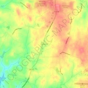
Name: Glenwood topographic map, elevation, terrain.
Location: Glenwood, Howard County, Maryland, 21738, United States (39.26753 -77.04761 39.30753 -77.00761)
Average elevation: 538 ft
Minimum elevation: 394 ft
Maximum elevation: 633 ft
Howard County trails, hiking, mountain biking, running and outdoor activities
Make a donation
Gear up for your next adventure:
As an Amazon Associate, this site earns from qualifying purchases at no extra cost to you.
Other topographic maps
Click on a map to view its topography, its elevation and its terrain.
Patapsco Valley State Park
United States > Maryland > Howard County > Ilchester
Average elevation: 430 ft