
Snake River topographic map
Click on the map to display elevation.
About this map
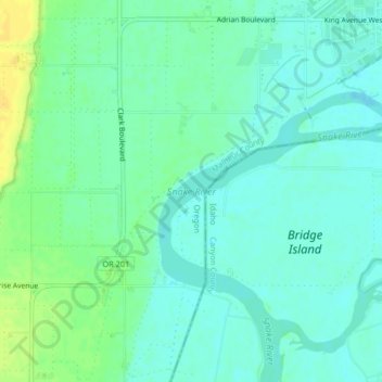
Name: Snake River topographic map, elevation, terrain.
Location: Snake River, Nyssa, Malheur County, Oregon, United States (43.84731 -117.02225 43.87250 -116.98133)
Average elevation: 2,195 ft
Minimum elevation: 2,169 ft
Maximum elevation: 2,241 ft
Malheur County trails, hiking, mountain biking, running and outdoor activities