
Thank you for supporting this site ❤️
Make a donation
Make a donation
Gear up for your next adventure:
As an Amazon Associate, this site earns from qualifying purchases at no extra cost to you.
Estoul topographic map
Click on the map to display elevation.
Thank you for supporting this site ❤️
Make a donation
Make a donation
Gear up for your next adventure:
As an Amazon Associate, this site earns from qualifying purchases at no extra cost to you.
About this map
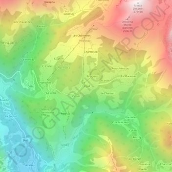
Name: Estoul topographic map, elevation, terrain.
Location: Estoul, Brusson, Valle d'Aosta, 11022, Italia (45.73799 7.74505 45.77799 7.78505)
Average elevation: 6,004 ft
Minimum elevation: 3,707 ft
Maximum elevation: 9,049 ft
Thank you for supporting this site ❤️
Make a donation
Make a donation
Gear up for your next adventure:
As an Amazon Associate, this site earns from qualifying purchases at no extra cost to you.