Geolocate

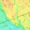
Family Park topographic map

Click on the map to display elevation.

About this map

Name: Family Park topographic map, elevation, terrain.

Location: Family Park, Kinuta Park, Setagaya, Tokyo, Japan (35.62847 139.61533 35.63290 139.62099)

Average elevation: 121 ft

Minimum elevation: 16 ft

Maximum elevation: 200 ft

Other topographic maps

Click on a map to view its topography, its elevation and its terrain.

Unane

Japan > Setagaya

Average elevation: 72 ft

Seijo 6

Japan > Setagaya

Average elevation: 131 ft

Seijo

Japan > Setagaya

Average elevation: 125 ft

Seijo

Japan > Setagaya

Average elevation: 125 ft

Seijo 6

Japan > Setagaya

Average elevation: 131 ft

Jakuzure River

Japan > Setagaya

Average elevation: 125 ft

Shimouma

Japan > Setagaya

Average elevation: 115 ft

Gear up for your next adventure:

🛶Inflatable Kayak - Portable kayak for rivers, lakes, and expeditions
🎒Outdoor Daypacks - Lightweight backpacks designed for carrying maps and essential gear
📌Outdoor GPS Map App - Apps and devices for digital topographic navigation
🥘Titanium Cookware - Durable, featherlight pots and pans for backpacking
👟Men's Trail Runners - Lightweight footwear for fast-paced exploration and light hiking

As an Amazon Associate, this site earns from qualifying purchases at no extra cost to you.