Geolocate

Mbalala topographic map

Click on the map to display elevation.

About this map

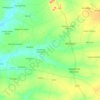
Name: Mbalala topographic map, elevation, terrain.

Location: Mbalala, Chibok, Borno State, Nigeria (10.68230 12.74946 10.84114 12.94857)

Average elevation: 1,509 ft

Minimum elevation: 1,388 ft

Maximum elevation: 1,762 ft

Gear up for your next adventure:

📻Weather Alert Radios - Stay informed of storm risks while off-the-grid
🧣Hiking Neck Gaiter - Multi‑use neck protection for outdoor weather
🪶Fire Starter Kit - Reliable fire starter for survival and camping
🛰️Handheld GPS Units - Professional satellite navigators for precise backcountry mapping
🔥Fast-Boil Camping Stoves - Efficient cooking systems for quick trail meals

As an Amazon Associate, this site earns from qualifying purchases at no extra cost to you.