
Thank you for supporting this site ❤️
Make a donation
Make a donation
Gear up for your next adventure:
As an Amazon Associate, this site earns from qualifying purchases at no extra cost to you.
Karoi topographic map
Click on the map to display elevation.
Thank you for supporting this site ❤️
Make a donation
Make a donation
Gear up for your next adventure:
As an Amazon Associate, this site earns from qualifying purchases at no extra cost to you.
About this map
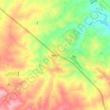
Name: Karoi topographic map, elevation, terrain.
Location: Karoi, Hurungwe, Mashonaland West Province, Zimbabwe (-16.85904 29.64369 -16.77904 29.72369)
Average elevation: 4,180 ft
Minimum elevation: 3,904 ft
Maximum elevation: 4,436 ft
Thank you for supporting this site ❤️
Make a donation
Make a donation
Gear up for your next adventure:
As an Amazon Associate, this site earns from qualifying purchases at no extra cost to you.