Geolocate

Italy topographic map

Click on the map to display elevation.

About this map

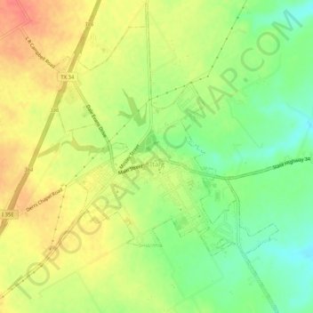
Name: Italy topographic map, elevation, terrain.

Location: Italy, Ellis County, Texas, 76651, United States (32.16341 -96.90794 32.20670 -96.86165)

Average elevation: 568 ft

Minimum elevation: 476 ft

Maximum elevation: 650 ft

Ellis County trails, hiking, mountain biking, running and outdoor activities

Other topographic maps

Click on a map to view its topography, its elevation and its terrain.

Boz

United States > Texas > Ellis County

Average elevation: 636 ft

Bristol

United States > Texas > Ellis County > Bristol

Average elevation: 456 ft

Ferris

United States > Texas > Ellis County > Ferris > Ferris

Average elevation: 446 ft

Five Points

United States > Texas > Ellis County

Average elevation: 584 ft

Gear up for your next adventure:

🛠️Outdoor Gear Repair Kit - Essential tools to fix gear on the trail
📚Navigation Handbooks - Master the art of reading topographic maps and using a compass
🛶Inflatable Kayak - Portable kayak for rivers, lakes, and expeditions
Solar GPS Watches - Advanced multisport watches with built-in topographic maps
📻Weather Alert Radios - Stay informed of storm risks while off-the-grid

As an Amazon Associate, this site earns from qualifying purchases at no extra cost to you.