

Danbury topographic map
Click on the map to display elevation.
Danbury
According to the United States Census Bureau, Danbury has a total area of 44.3 square miles (115 km2), of which 42.1 square miles (109 km2) is land and 2.2 square miles (5.7 km2), or 4.94%, is water. The city is located in the foothills of the Berkshire Mountains on low-lying land just south of Candlewood Lake (the City includes the southern parts of the lake). It developed along the Still River, which flows generally from west to east through the city before joining the Housatonic River. The city's terrain includes rolling hills and not-very-tall mountains to the west and northwest called the Western Highland. Ground elevations in the city range from 378 feet to 1,050 feet above sea level.
About this map
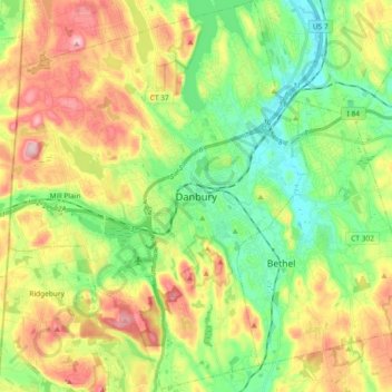
Name: Danbury topographic map, elevation, terrain.
Location: Danbury, Fairfield, Connecticut, United States of America (41.32577 -73.54342 41.46383 -73.40083)
Average elevation: 571 ft
Minimum elevation: 253 ft
Maximum elevation: 1,050 ft