
京当镇 topographic map
Interactive map
Click on the map to display elevation.
About this map
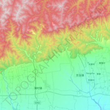
Name: 京当镇 topographic map, elevation, terrain.
Location: 京当镇, 岐山县, 宝鸡市, 陕西省, 中国 (34.44181 107.71845 34.59318 107.84848)
Average elevation: 3,281 ft
Minimum elevation: 1,936 ft
Maximum elevation: 5,420 ft
Other topographic maps
Click on a map to view its topography, its elevation and its terrain.