
Thank you for supporting this site ❤️
Make a donation
Make a donation
Gear up for your next adventure:
As an Amazon Associate, this site earns from qualifying purchases at no extra cost to you.
Manle topographic map
Click on the map to display elevation.
Thank you for supporting this site ❤️
Make a donation
Make a donation
Gear up for your next adventure:
As an Amazon Associate, this site earns from qualifying purchases at no extra cost to you.
About this map
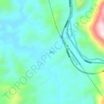
Name: Manle topographic map, elevation, terrain.
Location: Manle, Mengla County, Xishuangbanna, Yunnan, 666100, China (21.63050 101.34700 21.67050 101.38700)
Average elevation: 2,441 ft
Minimum elevation: 2,005 ft
Maximum elevation: 4,193 ft
Thank you for supporting this site ❤️
Make a donation
Make a donation
Gear up for your next adventure:
As an Amazon Associate, this site earns from qualifying purchases at no extra cost to you.