Geolocate

Newent topographic map

Click on the map to display elevation.

About this map
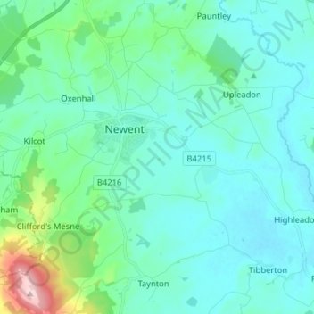
Name: Newent topographic map, elevation, terrain.

Location: Newent, Forest of Dean, Gloucestershire, England, United Kingdom (51.88396 -2.44646 51.96331 -2.34314)

Average elevation: 177 ft

Minimum elevation: 26 ft

Maximum elevation: 994 ft

Other topographic maps

Click on a map to view its topography, its elevation and its terrain.

Gear up for your next adventure:

🛰️Satellite Messengers - Emergency SOS and two-way messaging for off-grid adventures
🔊Portable Camp Speaker - Music and alerts at camp
🧦Hiking Socks - Comfortable socks to prevent blisters on long hikes
🌄Hiking Binoculars - Compact binoculars for scenic views and trail spotting
📦Gear Storage Bags - Organize and protect outdoor equipment

As an Amazon Associate, this site earns from qualifying purchases at no extra cost to you.