Geolocate

Annappes topographic map

Click on the map to display elevation.

About this map
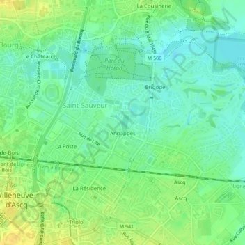
Name: Annappes topographic map, elevation, terrain.

Location: Annappes, Saint-Sauveur, Villeneuve-d'Ascq, Lille, Nord, Hauts-de-France, Metropolitan France, France (50.62319 3.13805 50.63250 3.15470)

Average elevation: 102 ft

Minimum elevation: 69 ft

Maximum elevation: 144 ft

Other topographic maps

Click on a map to view its topography, its elevation and its terrain.

Gear up for your next adventure:

🌐World Map Poster - Decorative world maps with topographic info
🥘Titanium Cookware - Durable, featherlight pots and pans for backpacking
🥇GPS Hiking Watch - Multi‑sport GPS watch with navigation and trail tracking
🏫Relief Map Kits - Hands-on tools for teaching landforms and elevation
🔦LED Headlamp - Bright and durable LED headlamp for night navigation

As an Amazon Associate, this site earns from qualifying purchases at no extra cost to you.