Geolocate

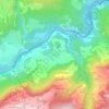
Versam topographic map

Click on the map to display elevation.

About this map

Name: Versam topographic map, elevation, terrain.

Location: Versam, Safiental, Surselva, Grisons, 7104, Switzerland (46.74254 9.30757 46.80920 9.38032)

Average elevation: 4,281 ft

Minimum elevation: 2,018 ft

Maximum elevation: 8,159 ft

Other topographic maps

Click on a map to view its topography, its elevation and its terrain.
Tenna

Switzerland > Grisons > Surselva > Safiental

Average elevation: 5,305 ft

Valendas

Switzerland > Grisons > Surselva > Safiental

Average elevation: 3,241 ft

Gear up for your next adventure:

⛺Backpacking Tents - Weight-optimized shelters for multi-day topographic surveys
☕Camping Coffee Makers - Enjoy premium coffee at the summit or campsite
🏕️Family Camping Gear - Essentials for group camping trips
🚑Emergency Bivvies - Heat-reflective sleeping bags for survival situations
🪶Thermal Camp Blanket - Extra warmth for cold nights

As an Amazon Associate, this site earns from qualifying purchases at no extra cost to you.