

Amelia topographic map
Click on the map to display elevation.
Amelia
Amelia is situated 24 kilometres (15 mi) from Terni and 13 kilometres (8.1 mi) from Narni on the slope of a hill at an elevation of about 406 metres (1,332 ft) above sea level, between the valley of the Tiber and that of the Nera, not far from the point where these rivers meet. The town occupies a position with a difference in elevation of about 75 metres (246 ft) across the settlement.
About this map
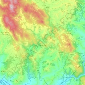
Name: Amelia topographic map, elevation, terrain.
Location: Amelia, Terni, Umbria, 05022, Italy (42.48592 12.30668 42.63005 12.47903)
Average elevation: 1,063 ft
Minimum elevation: 164 ft
Maximum elevation: 2,717 ft
Other topographic maps
Click on a map to view its topography, its elevation and its terrain.


