Geolocate

Amurang topographic map

Click on the map to display elevation.

About this map
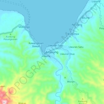
Name: Amurang topographic map, elevation, terrain.

Location: Amurang, Minahasa Selatan, North Sulawesi, 95957, Indonesia (1.14101 124.52988 1.22101 124.60988)

Average elevation: 285 ft

Minimum elevation: -3 ft

Maximum elevation: 1,657 ft

Gear up for your next adventure:

⛺Backpacking Tent - Lightweight and durable tent for multi‑day hikes
🍳Camping Cook Set - Complete cookware for outdoor meals
🪶Camping Sleeping Pad - Comfortable sleeping pad for backpacking
🧭Orienteering Set - Complete compass and map reading kit
🚗GPS Dash Cams - Record your scenic drives through mountain passes and canyons

As an Amazon Associate, this site earns from qualifying purchases at no extra cost to you.