Geolocate

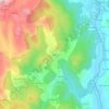
Abelenda topographic map

Click on the map to display elevation.

About this map

Name: Abelenda topographic map, elevation, terrain.

Location: Abelenda, Avión, Ribeiro, Orense, Galicia, España (42.33998 -8.32537 42.41454 -8.26248)

Average elevation: 2,375 ft

Minimum elevation: 1,004 ft

Maximum elevation: 3,438 ft

Other topographic maps

Click on a map to view its topography, its elevation and its terrain.

A Ponte Trado

España > Galicia > Ribeiro > Cortegada

Average elevation: 699 ft

Suido

España > Galicia > Ribeiro

Average elevation: 2,923 ft

Ramiras

España > Galicia > Ribeiro

Average elevation: 1,302 ft

Freás

España > Galicia > Ribeiro

Average elevation: 702 ft

Barral

España > Galicia > Ribeiro

Average elevation: 620 ft

Carballa Redonda

España > Galicia > Ribeiro

Average elevation: 2,448 ft

Rubillón

España > Galicia > Ribeiro

Average elevation: 2,149 ft

Berán

España > Galicia > Ribeiro > Leiro

Average elevation: 797 ft

A Insua

España > Galicia > Ribeiro > Ribadavia

Average elevation: 610 ft

Rego de Abaixo

España > Galicia > Ribeiro

Average elevation: 1,010 ft

Cima de Vila

España > Galicia > Ribeiro > Carballeda de Avia

Average elevation: 1,683 ft

Laias

España > Galicia > Ribeiro

Average elevation: 709 ft

Osmo

España > Galicia > Ribeiro

Average elevation: 958 ft

Razamonde

España > Galicia > Ribeiro > Xubín

Average elevation: 735 ft

Meizo

España > Galicia > Ribeiro

Average elevation: 1,155 ft

O Coedo

España > Galicia > Ribeiro

Average elevation: 728 ft

Vilar de Rei

España > Galicia > Ribeiro

Average elevation: 1,119 ft

A Veiga

España > Galicia > Ribeiro > Carballeda de Avia

Average elevation: 571 ft

Encoro de Castrelo

España > Galicia > Ribeiro > Ribadavia > Santa María

Average elevation: 486 ft

Astariz

España > Galicia > Ribeiro

Average elevation: 676 ft

Vilar de Condes

España > Galicia > Ribeiro

Average elevation: 1,654 ft

Prexigueiro

España > Galicia > Ribeiro

Average elevation: 709 ft

San Tomé de Serantes

España > Galicia > Ribeiro

Average elevation: 1,181 ft

Gear up for your next adventure:

💧Water Purification System - Clean water on the trail with reliable purifiers
🥩Freeze-Dried Meals - Nutritious and lightweight food for remote expeditions
🪑Ultralight Camp Chairs - Portable seating for resting after a long day of mapping
🔪Outdoor Multitools - Essential survival tools for gear repair and field use
📡Handheld GPS Device - Reliable handheld GPS for outdoor navigation

As an Amazon Associate, this site earns from qualifying purchases at no extra cost to you.