Geolocate

Llavac topographic map

Click on the map to display elevation.

About this map

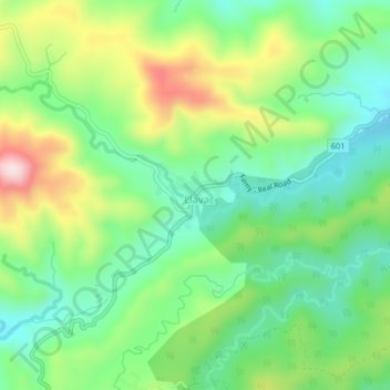
Name: Llavac topographic map, elevation, terrain.

Location: Llavac, Real, Quezon, Calabarzon, 4335, Philippines (14.50129 121.51595 14.54129 121.55595)

Average elevation: 1,204 ft

Minimum elevation: 814 ft

Maximum elevation: 1,916 ft

Gear up for your next adventure:

🗃️Trail First Aid Kit - Essential kit for outdoor injuries and emergencies
📚Navigation Handbooks - Master the art of reading topographic maps and using a compass
📖Nature Tracking Books - Learn to track wildlife and terrain
🔦Powerful Headlamps - Ultra-bright hands-free lighting for night navigation
🔭Telescopic Hiking Pole - Adjustable pole for hiking stability

As an Amazon Associate, this site earns from qualifying purchases at no extra cost to you.