Geolocate

Brandenburg topographic map

Click on the map to display elevation.

About this map

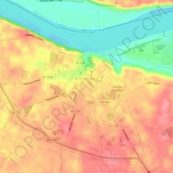
Name: Brandenburg topographic map, elevation, terrain.

Location: Brandenburg, Meade County, Kentucky, United States (37.97907 -86.20292 38.01498 -86.15105)

Average elevation: 551 ft

Minimum elevation: 374 ft

Maximum elevation: 676 ft

Meade County trails, hiking, mountain biking, running and outdoor activities

Other topographic maps

Click on a map to view its topography, its elevation and its terrain.

Cold Springs

United States > Kentucky > Meade County

Average elevation: 627 ft

Gear up for your next adventure:

👓Polarized Sunglasses - Outdoor sunglasses for glare reduction
🧺Microfiber Travel Towels - Compact and fast-drying towels for trail use
🦺Reflective Outdoor Gear - Safety gear for low‑light conditions
🧴Hand Sanitizer - Keep hands clean while hiking
🍳Camping Cook Set - Complete cookware for outdoor meals

As an Amazon Associate, this site earns from qualifying purchases at no extra cost to you.