Geolocate

Yavne topographic map

Click on the map to display elevation.

About this map

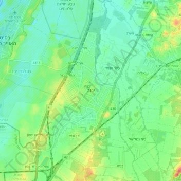
Name: Yavne topographic map, elevation, terrain.

Location: Yavne, Rehovot Subdistrict, Center District, Israel (31.83689 34.69830 31.91689 34.77830)

Average elevation: 89 ft

Minimum elevation: 10 ft

Maximum elevation: 276 ft

Gear up for your next adventure:

🧯Emergency Survival Kit - All‑in‑one survival essentials for the backcountry
🧢Sun Protection Hats - Wide-brimmed and UPF-rated hats for high-altitude sun safety
🔭Compact Binoculars - HD vision for scouting terrain and identifying distant landmarks
🧭GPS Watch Accessories - Bands and chargers for GPS watches
🚁Photography Drones - Capture stunning aerial views of landforms and topography

As an Amazon Associate, this site earns from qualifying purchases at no extra cost to you.