
Tello topographic map
Click on the map to display elevation.
Tello
Tello es un municipio colombiano ubicado en el departamento de Huila. Se caracteriza por su extensa llanura comprendida entre el río Magdalena y el pie de la cordillera oriental hasta sus cimas, con más de 3000 msnm, regados por las aguas de los ríos Fortalecillas y Villavieja. Su extensión territorial es de 589 km², su altitud es de 575 msnm y su clima es cálido con una temperatura promedio de 26ºC.
About this map
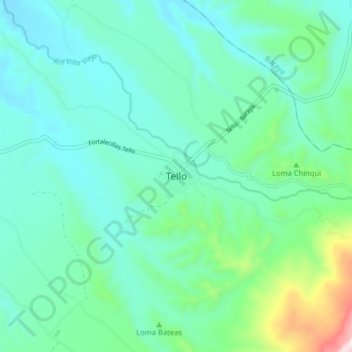
Name: Tello topographic map, elevation, terrain.
Location: Tello, Norte, Huila, Colombia (3.02721 -75.17928 3.10721 -75.09928)
Average elevation: 1,982 ft
Minimum elevation: 1,552 ft
Maximum elevation: 3,773 ft