
Kankakee topographic map
Click on the map to display elevation.
Kankakee
Greater Kankakee Airport covers an area of 950 acres (380 ha) (384 ha) at an elevation of 629 feet (192 m) above mean sea level. It has two runways with asphalt surfaces: 4/22 is 5,981 by 100 feet (1,823 x 30 m) and 16/34 is 4,398 by 75 feet (1,341 x 23 m).
About this map
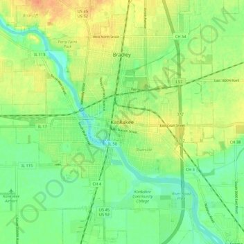
Name: Kankakee topographic map, elevation, terrain.
Location: Kankakee, Kankakee County, Illinois, 60901, United States (41.08003 -87.90115 41.16003 -87.82115)
Average elevation: 640 ft
Minimum elevation: 584 ft
Maximum elevation: 702 ft
Kankakee County trails, hiking, mountain biking, running and outdoor activities