Geolocate

Gettysburg topographic map

Click on the map to display elevation.

About this map

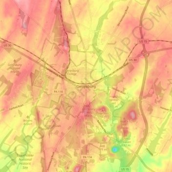
Name: Gettysburg topographic map, elevation, terrain.

Location: Gettysburg, Adams County, Pennsylvania, 17325, United States (39.79090 -77.27101 39.87090 -77.19101)

Average elevation: 535 ft

Minimum elevation: 279 ft

Maximum elevation: 659 ft

Adams County trails, hiking, mountain biking, running and outdoor activities

Gear up for your next adventure:

🪶Wildlife Field Guides - Learn animal tracking and species ID
😴Insulated Sleeping Pads - Compact and warm pads for high-elevation camping
🛰️Satellite Messengers - Emergency SOS and two-way messaging for off-grid adventures
🧼Biodegradable Camping Soap - Eco‑friendly soap for outdoor hygiene
💧Water Purification System - Clean water on the trail with reliable purifiers

As an Amazon Associate, this site earns from qualifying purchases at no extra cost to you.