Geolocate

Salbani topographic map

Click on the map to display elevation.

About this map

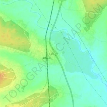
Name: Salbani topographic map, elevation, terrain.

Location: Salbani, Paschim Medinipur, West Bengal, 721147, India (22.62024 87.30425 22.66024 87.34425)

Average elevation: 121 ft

Minimum elevation: 79 ft

Maximum elevation: 184 ft

Gear up for your next adventure:

🔥Camping Stove - Portable stove for camping and backcountry cooking
🧺Microfiber Travel Towels - Compact and fast-drying towels for trail use
🏥Hiking First Aid Kits - Comprehensive medical kits for remote trail injuries
👖Convertible Hiking Pants - Versatile zip-off pants for changing altitudes and temperatures
🎒Trekking Poles - Sturdy poles for balance and stability on rough terrain

As an Amazon Associate, this site earns from qualifying purchases at no extra cost to you.