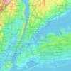
Freshkills Park topographic map
Click on the map to display elevation.
Freshkills Park
The initial plan was to raise the elevation of the land by filling for three years and then to redevelop it as a multi-use area with residential, recreational, and industrial components. However, three years turned into fifty years. New York City's population was growing and generating more trash and it was easy to expand the filling operation on Staten Island. The landfill accepted garbage from 1948 through 2001. By 1955, the landfill was the largest in the world. At the peak of its operation, the contents of twenty barges – each carrying 650 tons of garbage – were added to the site every day. By 1996, the mound had reached a height of 175 feet (53 m), taller than the Statue of Liberty in nearby New York Harbor. Although Staten Islanders had tried many times to close operations at the landfill, litigation efforts finally met with success that year, when regulations were passed to close the landfill by 2002. Under strong community pressure and with support of the United States Environmental Protection Agency (EPA), the landfill site was closed on March 22, 2001, but it was reopened after the September 11 attacks on the World Trade Center in Manhattan. Virtually all the materials from the World Trade Center site were sent to the temporarily reopened landfill for examination. Thousands of detectives and forensic evidence specialists worked for over 1.7 million hours at Fresh Kills Landfill to try to recover the remains of people killed in the attacks. A final count of 4,257 human remains were recovered, and more than 1,600 personal effects; the City's Chief Medical Examiner retains custody of all still-unidentified materials at a facility within the National 9/11 Memorial in Manhattan. The remaining materials at Fresh Kills were then buried in a 40-acre (160,000 m2) portion of the landfill, known as West Mound. Afterward, the landfill facility was closed permanently, in anticipation of the park on the site.
About this map

Name: Freshkills Park topographic map, elevation, terrain.
Location: Freshkills Park, New York, United States (40.55581 -74.21368 40.60287 -74.16369)
Average elevation: 36 ft
Minimum elevation: -13 ft
Maximum elevation: 174 ft
New York trails, hiking, mountain biking, running and outdoor activities
Other topographic maps
Click on a map to view its topography, its elevation and its terrain.
Central Park
United States > New York > New York
In June 1856, Fernando Wood appointed a "consulting board" of seven people, headed by author Washington Irving, to inspire public confidence in the proposed development. Wood hired military engineer Egbert Ludovicus Viele as the park's chief engineer, tasking him with a topographical survey of the site. The…
Average elevation: 85 ft

Snug Harbor Cultural Center and Botanical Garden
United States > New York > New York
Building C, also known as the Administration Building, was completed in 1833 and is Lafever's oldest surviving work. As of 2020, building C houses part of the Newhouse Center for Contemporary Art. The building consists of two stories, a raised basement, and an attic; it is rectangular in plan with a gable…
Average elevation: 66 ft


Flushing Meadows-Corona Park
United States > New York > New York
Around 1907, contractor Michael Degnon, whose firm constructed the Williamsburg Bridge, the Cape Cod Canal, and the Steinway subway tunnel (used by today's 7 and <7> trains), purchased large tracts of marsh near Flushing Creek. At the time, the land was considered "all but worthless". Degnon envisioned…
Average elevation: 49 ft
Snug Harbor Cultural Center and Botanical Garden
United States > New York > New York
Building C, also known as the Administration Building, was completed in 1833 and is Lafever's oldest surviving work. It houses part of the Newhouse Center for Contemporary Art. The building consists of two stories, a raised basement, and an attic; it is rectangular in plan with a gable roof. The main entrance…
Average elevation: 66 ft