
Thank you for supporting this site ❤️
Make a donation
Make a donation
Gear up for your next adventure:
As an Amazon Associate, this site earns from qualifying purchases at no extra cost to you.
Labebene topographic map
Click on the map to display elevation.
Thank you for supporting this site ❤️
Make a donation
Make a donation
Gear up for your next adventure:
As an Amazon Associate, this site earns from qualifying purchases at no extra cost to you.
About this map
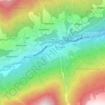
Name: Labebene topographic map, elevation, terrain.
Location: Labebene, Gemeinde See, Bezirk Landeck, Tirol, Österreich (47.06540 10.39636 47.06705 10.39971)
Average elevation: 4,941 ft
Minimum elevation: 3,629 ft
Maximum elevation: 7,031 ft
Thank you for supporting this site ❤️
Make a donation
Make a donation
Gear up for your next adventure:
As an Amazon Associate, this site earns from qualifying purchases at no extra cost to you.