
Lealman topographic map
Click on the map to display elevation.
Lealman
Lealman is located at 27°49′10″N 82°41′4″W / 27.81944°N 82.68444°W / 27.81944; -82.68444 (27.8197, -82.6846). The community is bordered by the city of Pinellas Park to the north, St. Petersburg to the east and south, and by the town of West Lealman to the west. The elevation is 49 feet (15 m) above sea level.
About this map
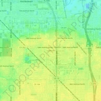
Name: Lealman topographic map, elevation, terrain.
Location: Lealman, Pinellas County, Florida, 33714, United States (27.79979 -82.70226 27.83979 -82.66226)
Average elevation: 43 ft
Minimum elevation: -3 ft
Maximum elevation: 69 ft
Pinellas County trails, hiking, mountain biking, running and outdoor activities
Other topographic maps
Click on a map to view its topography, its elevation and its terrain.
A.L. Anderson Park
United States > Florida > Pinellas County > Tarpon Springs
Average elevation: 16 ft
Pine Key
United States > Florida > Pinellas County > Tierra Verde > Tierra Verde
Average elevation: 3 ft
Redington Shores
United States > Florida > Pinellas County
According to the United States Census Bureau, the town has a total area of 1.2 square miles (3.1 km2), of which 0.4 square miles (1.0 km2) is land and 0.8 square miles (2.1 km2) (67.50%) is water. According to Elevation Map Logs, the elevation of Redington Shores is just one meter above sea level.
Average elevation: 7 ft
West and East Lealman
United States > Florida > Pinellas County
"West and East Lealman" was located at 27°49′12″N 82°41′12″W / 27.82000°N 82.68667°W / 27.82000; -82.68667 (27.820103, -82.686670). The community is adjacent to the cities of Pinellas Park, St. Petersburg, and Kenneth City. The elevation is 49 feet (15 m) above sea level.
Average elevation: 33 ft
West and East Lealman
United States > Florida > Pinellas County > Saint Petersburg
"West and East Lealman" was located at 27°49′12″N 82°41′12″W / 27.82000°N 82.68667°W / 27.82000; -82.68667 (27.820103, -82.686670). The community is adjacent to the cities of Pinellas Park, St. Petersburg, and Kenneth City. The elevation is 49 feet (15 m) above sea level.
Average elevation: 39 ft