Geolocate

Wesel topographic map

Click on the map to display elevation.

About this map

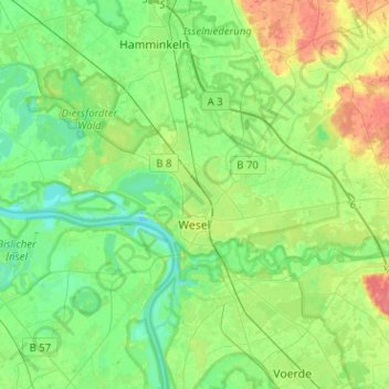
Name: Wesel topographic map, elevation, terrain.

Location: Wesel, Kreis Wesel, North Rhine-Westphalia, Germany (51.61630 6.46031 51.72361 6.71373)

Average elevation: 85 ft

Minimum elevation: 26 ft

Maximum elevation: 207 ft

Other topographic maps

Click on a map to view its topography, its elevation and its terrain.

Labbeck

Germany > North Rhine-Westphalia > Kreis Wesel

Average elevation: 141 ft

Gear up for your next adventure:

📡Handheld GPS Device - Reliable handheld GPS for outdoor navigation
🌡️Portable Weather Meter - Track weather conditions on the trail
🔌USB Car Charger - Car charger for on‑the‑go power needs
🛠️Backpacking Tool Kit - Essential toolkit for outdoor repairs
🔭Stargazing Telescopes - Perfect for camping in low-light pollution areas shown on maps

As an Amazon Associate, this site earns from qualifying purchases at no extra cost to you.