Geolocate

Nabawan topographic map

Click on the map to display elevation.

About this map

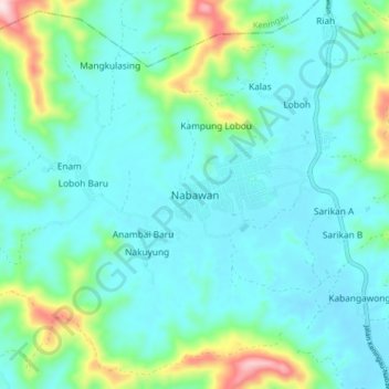
Name: Nabawan topographic map, elevation, terrain.

Location: Nabawan, Sabah, 89957, Malaysia (4.99973 116.38583 5.07973 116.46583)

Average elevation: 1,693 ft

Minimum elevation: 1,447 ft

Maximum elevation: 2,749 ft

Gear up for your next adventure:

⛑️Personal Locator Beacon - Safety beacon for emergencies
👟Men's Trail Runners - Lightweight footwear for fast-paced exploration and light hiking
📷Action Camera - Capture your outdoor adventures in HD
🧥Men's Rain Shells - Premium waterproof and breathable jackets for mountain weather
🏔️Mountain Trail Maps - High‑detail maps for popular peaks

As an Amazon Associate, this site earns from qualifying purchases at no extra cost to you.