
Thank you for supporting this site ❤️
Make a donation
Make a donation
Gear up for your next adventure:
As an Amazon Associate, this site earns from qualifying purchases at no extra cost to you.
Chushul topographic map
Click on the map to display elevation.
Thank you for supporting this site ❤️
Make a donation
Make a donation
Gear up for your next adventure:
As an Amazon Associate, this site earns from qualifying purchases at no extra cost to you.
About this map
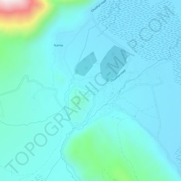
Name: Chushul topographic map, elevation, terrain.
Location: Chushul, Leh Tehsil, Leh district, Ladakh, India (33.58122 78.62306 33.62122 78.66306)
Average elevation: 14,419 ft
Minimum elevation: 14,157 ft
Maximum elevation: 16,319 ft
Thank you for supporting this site ❤️
Make a donation
Make a donation
Gear up for your next adventure:
As an Amazon Associate, this site earns from qualifying purchases at no extra cost to you.