Geolocate

Cleveland topographic map

Click on the map to display elevation.

About this map

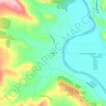
Name: Cleveland topographic map, elevation, terrain.

Location: Cleveland, Douglas County, Oregon, United States (43.27623 -123.49647 43.31623 -123.45647)

Average elevation: 561 ft

Minimum elevation: 322 ft

Maximum elevation: 1,096 ft

Douglas County trails, hiking, mountain biking, running and outdoor activities

Gear up for your next adventure:

🚗GPS Dash Cams - Record your scenic drives through mountain passes and canyons
☀️Outdoor Sunscreen - High protection sunscreen for outdoor activities
🛡️Insect Repellent - Protection against bugs during outdoor activities
Backpacking Tent - Lightweight and durable tent for multi‑day hikes
🦶Hiking Gaiters - Keep debris and water out of your boots

As an Amazon Associate, this site earns from qualifying purchases at no extra cost to you.