Geolocate

Accomac topographic map

Click on the map to display elevation.

About this map

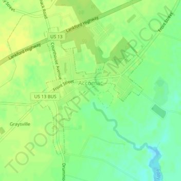
Name: Accomac topographic map, elevation, terrain.

Location: Accomac, Accomack County, Virginia, United States (37.70887 -75.67607 37.72796 -75.65558)

Average elevation: 39 ft

Minimum elevation: -10 ft

Maximum elevation: 62 ft

Accomack County trails, hiking, mountain biking, running and outdoor activities

Other topographic maps

Click on a map to view its topography, its elevation and its terrain.

Hacksneck

United States > Virginia > Accomack County

Average elevation: 3 ft

Saxis Island

United States > Virginia > Accomack County > Saxis

Average elevation: 7 ft

The Notch

United States > Virginia > Accomack County

Average elevation: 7 ft

Oak Hall

United States > Virginia > Accomack County

It lies at an elevation of 26 feet.

Average elevation: 33 ft

Deep Creek

United States > Virginia > Accomack County

Average elevation: 3 ft

Upper Tump

United States > Virginia > Accomack County

Average elevation: 0 ft

Gear up for your next adventure:

Backpacking Tents - Weight-optimized shelters for multi-day topographic surveys
📡GPS Antenna Upgrade - Enhance GPS reception in remote terrain
🔦LED Headlamp - Bright and durable LED headlamp for night navigation
☀️Outdoor Sunscreen - High protection sunscreen for outdoor activities
🪄Magnetic Compass - Accurate compass for navigation

As an Amazon Associate, this site earns from qualifying purchases at no extra cost to you.