
Thank you for supporting this site ❤️
Make a donation
Make a donation
Gear up for your next adventure:
As an Amazon Associate, this site earns from qualifying purchases at no extra cost to you.
Ghebbala topographic map
Click on the map to display elevation.
Thank you for supporting this site ❤️
Make a donation
Make a donation
Gear up for your next adventure:
As an Amazon Associate, this site earns from qualifying purchases at no extra cost to you.
About this map
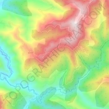
Name: Ghebbala topographic map, elevation, terrain.
Location: Ghebbala, Achniw, Chekfa, Daïra Chekfa, Jijel, Algérie (36.69280 5.96712 36.73280 6.00712)
Average elevation: 1,365 ft
Minimum elevation: 295 ft
Maximum elevation: 2,592 ft
Thank you for supporting this site ❤️
Make a donation
Make a donation
Gear up for your next adventure:
As an Amazon Associate, this site earns from qualifying purchases at no extra cost to you.