Geolocate

Mukteshwar topographic map

Click on the map to display elevation.

About this map

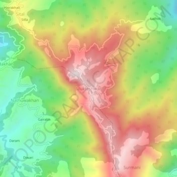
Name: Mukteshwar topographic map, elevation, terrain.

Location: Mukteshwar, Dhari, Nainital, Uttarakhand, 263138, India (29.45208 79.62804 29.49208 79.66804)

Average elevation: 6,503 ft

Minimum elevation: 5,423 ft

Maximum elevation: 7,621 ft

Gear up for your next adventure:

🦟Ultrasonic Repellers - Create a bug-free zone at your camp or rest stop
🦺Reflective Outdoor Gear - Safety gear for low‑light conditions
📚Navigation Handbooks - Master the art of reading topographic maps and using a compass
😴Insulated Sleeping Pads - Compact and warm pads for high-elevation camping
🕶️Glacier Sunglasses - Side shields to protect eyes from high-altitude snow glare

As an Amazon Associate, this site earns from qualifying purchases at no extra cost to you.