Geolocate

Snakehead Point topographic map

Click on the map to display elevation.

About this map

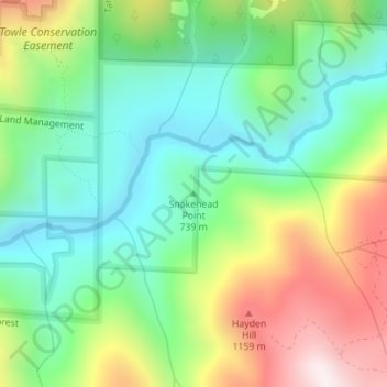
Name: Snakehead Point topographic map, elevation, terrain.

Location: Snakehead Point, Placer County, California, United States (39.17540 -120.78082 39.17550 -120.78072)

Average elevation: 2,680 ft

Minimum elevation: 1,804 ft

Maximum elevation: 4,226 ft

Placer County trails, hiking, mountain biking, running and outdoor activities

Other topographic maps

Click on a map to view its topography, its elevation and its terrain.

Avery's Pond

United States > California > Placer County

Average elevation: 620 ft

Deer Lake

United States > California > Placer County

Average elevation: 6,624 ft

Lincoln

United States > California > Placer County

Average elevation: 112 ft

Auburn Ravine

United States > California > Placer County > Auburn

Average elevation: 814 ft

Tahoe Vista

United States > California > Placer County > Kings Beach

Average elevation: 6,644 ft

Dollar Point

United States > California > Placer County

Average elevation: 6,414 ft

Lincoln

United States > California > Placer County

Average elevation: 197 ft

Gear up for your next adventure:

🔦Powerful Headlamps - Ultra-bright hands-free lighting for night navigation
⛑️Personal Locator Beacon - Safety beacon for emergencies
🩳Quick‑Dry Hiking Shorts - Comfortable and quick‑dry shorts for summer hiking
🔥Plasma Lighters - Windproof lighters that work in any weather condition
🎒Day Hiking Backpack - Lightweight backpack perfect for day trips and outdoor adventures

As an Amazon Associate, this site earns from qualifying purchases at no extra cost to you.