Geolocate

Hisar topographic map

Click on the map to display elevation.

About this map

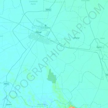
Name: Hisar topographic map, elevation, terrain.

Location: Hisar, Haryana, India (28.89713 75.62947 29.26424 75.90767)

Average elevation: 702 ft

Minimum elevation: 676 ft

Maximum elevation: 1,237 ft

Other topographic maps

Click on a map to view its topography, its elevation and its terrain.

Khedar

India > Haryana > Barwala

Average elevation: 715 ft

Rohtak

India > Haryana > Rohtak

Average elevation: 728 ft

Murthal

India > Haryana > Sonipat

Average elevation: 719 ft

Malra

India > Haryana > Mahendragarh > Malra

Average elevation: 837 ft

Faridabad

India > Haryana > Faridabad

Average elevation: 712 ft

Bhud Pur

India > Haryana > Rewari > Bhud Pur

Average elevation: 797 ft

Central Park

India > Haryana > Gurugram

Average elevation: 814 ft

Panipat

India > Haryana > Panipat

Panipat is located at 29°23′15″N 76°58′12″E / 29.3875°N 76.9700°E / 29.3875; 76.9700.[12] It has an average elevation of 219 metres (718 feet).

Average elevation: 771 ft

Kundli

India > Haryana > Sonipat

Average elevation: 699 ft

Gear up for your next adventure:

🔪Outdoor Multitools - Essential survival tools for gear repair and field use
🩹Survival Bandages - High‑quality bandages for emergencies
🚑Emergency Bivvies - Heat-reflective sleeping bags for survival situations
🔥Fast-Boil Camping Stoves - Efficient cooking systems for quick trail meals
🛰️Satellite Messengers - Emergency SOS and two-way messaging for off-grid adventures

As an Amazon Associate, this site earns from qualifying purchases at no extra cost to you.